Land-use and spatial planning - RIBASIM
Land-use and spatial planning
4 February 2021
The integrated water resources management (IWRM) planning process needs input from spatial projections of land use and population. Those future projections must be consistent on:
-
the spatial distribution at local level of the population and employment;
-
the urban area growth needed to accommodate human activities; and
-
the land-use changes caused by the urban area growth,
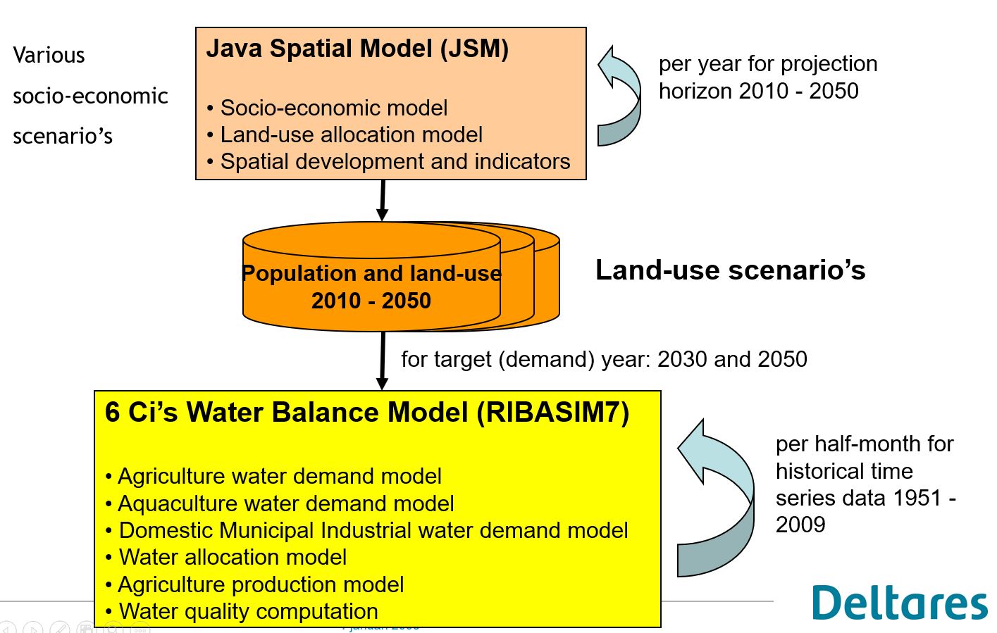
The land-use and population data are used for the computation of the demands. In RIBASIM those data can be specified as
-
Model data input for the various network elements (nodes and links).
-
Land-use and spatial planning models like the Java Spatial Model (JSM). JSM is a dedicated model for the island of Java, Indonesia. This type of models computes at regional level the population growth and migration and allocates space demand at regional level to village level based on preferences of residents and zoning policy. The time series of population and land-use over the projection time period is directly used by RIBASIM. All population and land-use time series are linked to RIBASIM as a defined socio-economic scenario. The user selects the actual simulated scenario at the start of the simulation run.
Additionally, demand measures can be defined in RIBASIM which can be combined with other measures to management actions (strategies, interventions). The user selects the actual simulated management action at the start of the simulation run.

Decrease of rice field (sawah) area in West Java (Indonesia) computed by Java Spatial Model

Growth of urban area in West Java including Jakarta (Indonesia) computed by Java Spatial Model

