Catchment rainfall-runoff - RIBASIM
Catchment rainfall-runoff
4 February 2021
The surface water availability In RIBASIM can be modelled various ways:
-
As an explicitly defined multiple year time series. Those time series can be prepared using monitoring time series or can be generated outside RIBASIM with the Deltares distributed rainfall-runoff model Wflow. Any rainfall-runoff model can be linked to RIBASIM.
-
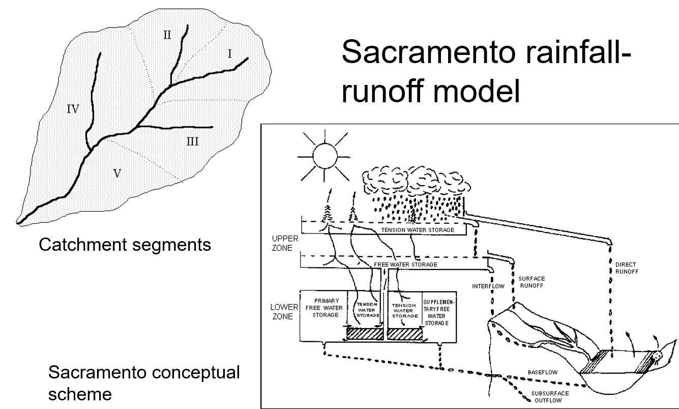
RIBASIM also includes the Sacramento rainfall-runoff model. This catchment model is a lumped model which has been tested on a variety of catchments around the world. It is used to determine the catchment runoff and it can be applied to a broad range of catchment types. The land-phase is represented by an explicit moisture accounting lumped parameter model, where the catchment area is divided into one or more segments discharging to the main channels.
All hydrological time series like boundary inflow, runoff, rainfall and evaporation are linked to RIBASIM as a defined hydrological scenario. The user selects the actual simulated scenario at the start of the simulation run. A hydrological scenario can represent a climate change scenario.

Link between rainfall-runoff model Wflow and RIBASIM

Wflow sub-basin schematization of the Meuse River basin

Sub-basin schematization of the Oum Er Rbia, Bouregreg, Sebou and Loukkos River basins (Morocco)

